
Your bag is empty
Don't miss out on great deals! Start shopping or Sign in to view products added.
Shop What's New Sign in£15.47 Save:£5.00(23%)
Available in stock
| Print length: | 436 pages |
|---|---|
| Language: | English |
| Publisher: | Geographers’ A-Z Map Co Ltd |
| Publication date: | 3 Mar. 2022 |
| Dimensions: | 21.01 x 2.29 x 29.69 cm |
| ISBN-10: | 0008513686 |
| ISBN-13: | 978-0008513689 |
 Invincible Compendium Volume 2 (INVINCIBLE COMPENDIUM TP)
£35.41
 The New GCSE Arabic Companion (9-1)
£23.75
 Of Mice and Men (New Longman Literature - Plain Edition)
£2.92
 The Red Rising Series Collection 5 Books Set By Pierce Brown (Red Rising, Golden Son, Morning Star, Iron Gold, Dark Age)
£18.67
 Dead Girls Don't Talk - Amazon Exclusive Edition: A YA thriller about a murdered girl, but if you flip over the book you can read from the killer's POV.
£12.54
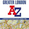
The ultimate street atlas to navigate your way around London. A comprehensive paperback street atlas of London encompassing an area of 1,450 square miles with coloured street mapping, and including more than 90,000 streets and other addresses. The coverage extends beyond the Greater London and M25 area to: Hemel Hempstead, St. Albans, Potters Bar, Waltham Cross, Epping, Brentwood, Thurrock, Stanford-le-Hope, Gravesend, Wrotham, Sevenoaks, Westerham, Oxted, Redhill, Reigate, Leatherhead, Great Bookham, Woking, Egham, Windsor, Slough, Chalfont St. Peter, Chorleywood, Bovingdon There are eighteen pages of large scale (9″” to 1 mile) street mapping of central London which gives additional clarity and detail, this mapping extends to: Regent’s Park, St. Pancras International Station, Old Street, Tower Bridge, Bricklayer’s Arms Junction, Vauxhall Bridge, South Kensington, Paddington Station and Lord’s Cricket Ground. Postcode districts and one-way streets are included on the street mapping. Other features include: • The Congestion Charging Zone (CCZ) boundary which is shown on both scales of mapping and an overview map of the zone is also included. • The Greater London Low Emission Zone boundary is shown on the street mapping and an overview map of the zone is also included. • The Ultra Low Emission Zone (ULEZ) boundary • There are eight pages of road mapping at 3 miles to 1 inch that cover much of the Home Counties area. • London Underground map. • London Rail Connections map. • West End Cinema and Theatre maps. The index section of the atlas includes streets, places & areas, hospitals, industrial estates, selected flats & walkways, service areas, stations and selected places of interest. Please note hospitals and rail stations are now listed in the main index and highlighted in different colour. They are not included as a separate list as in previous editions. – ASIN: 0008513686 | ISBN13: 9780008513689 | ISBN-13: 978-0008513689
You must be logged in to post a review.


Reviews
There are no reviews yet.