
Your bag is empty
Don't miss out on great deals! Start shopping or Sign in to view products added.
Shop What's New Sign in£10.58 Save:£4.00(26%)
Available in stock
| Print length: | 256 pages |
|---|---|
| Language: | English |
| Publisher: | Trailblazer Publications |
| Publication date: | 7 Sept. 2023 |
| Dimensions: | 12.19 x 1.52 x 18.03 cm |
| ISBN-10: | 1912716399 |
| ISBN-13: | 978-1912716395 |
 Invincible Compendium Volume 2 (INVINCIBLE COMPENDIUM TP)
£35.41
 The New GCSE Arabic Companion (9-1)
£23.75
 Of Mice and Men (New Longman Literature - Plain Edition)
£2.92
 The Red Rising Series Collection 5 Books Set By Pierce Brown (Red Rising, Golden Son, Morning Star, Iron Gold, Dark Age)
£18.67
 Dead Girls Don't Talk - Amazon Exclusive Edition: A YA thriller about a murdered girl, but if you flip over the book you can read from the killer's POV.
£12.54
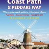
All the information you need to enjoy your hiking adventure along the Norfolk Coast Path and Peddars Way. The Norfolk Coast Path & Peddars Way cover 130-miles of walking trails. The Peddars Way runs through East Anglia from Knettishall Heath on the Norfolk/Suffolk border and follows a Roman road to Holme-next-the-Sea. From here it becomes the Norfolk Coast Path, hugging the beautiful Norfolk coastline through Holkham, Wells, Blakeney and Cley to Cromer before it rounds the shoulder of the county and continues along the superb beaches and crumbling cliffs to Mundesley, Sea Palling and Great Yarmouth, finishing just before the Suffolk border. Includes: 77 large-scale walking maps – at just under 1: 20,000 (8cm or 3 and one eighth inches to 1 mile) our maps are bigger than even the most detailed walking maps currently available, with walking directions, tricky junctions, places to stay and eat, points of interest and walking times written onto the maps Text and maps in clear TWO-COLOUR style All standards of accommodation with reviews – campsites, B&Bs, hostels, hotels, bunkhouses Where to eat with reviews – cafes, teashops, pubs, takeaways and restaurants Detailed public transport information – for all villages and towns along the paths Itineraries for all walkers – including one day Peddars Way and Norfolk Coast Path walks, car parks near the trail for weekend and day walkers Includes 40 mile extension of the National Trail from Cromer to Hopton-on-Sea Downloadable GPS waypoints with what3words refs Colour pictures – including a 6 page colour bird and flower guide Historical, cultural and geographical background information – ASIN: 1912716399 | ISBN13: 9781912716395 | ISBN-13: 978-1912716395
You must be logged in to post a review.


Reviews
There are no reviews yet.